New Zealand: Queenstown

10 05 2011

After nearly two weeks of traversing New Zealand from North to South, we finally reached our last destination – beautiful  Queenstown.  Queenstown is a resort town on the southwest corner of the South Island that is known for its adventure tourism.  This beauty of a town is ideally situated on an inlet called Queenstown Bay on Lake Wakatipu that is further surrounded by majestic mountain ranges.


View of Queenstown from the top of the gondola on a cloudy day.

We arrived at around dusk and only had a few minutes to walk around the downtown area before dark.  The town has a very cozy, vacation vibe to it.  People were out and about enjoying the night.


I spy a KFC and the Queenstown gondola.

There are a number of restaurants, from casual to upscale. Many featured seafood.  We had a fantastic view of Queenstown from one of the seafood restaurants on the dock.  We lucked out and got the best table in the house!  The day we arrived, we had stopped by the restaurant before the dinner rush and happened to speak to the manager, who told us to request this table.  Everyone is so nice here!


View of Queenstown from one of our dinners.


Another lovely New Zealand sunset.

The town itself is small – there is only one stoplight and the widest part is probably about 6 blocks.  The town is oddly shaped with two long arms that hug the lake radiating from the downtown area.  Another part of the town lies on a peninsula across from downtown. In a town of this size, it is possible to buy whatever you might need, but there is probably only one store of each type.

On another day, we rode up the Queenstown gondola to see the view.  Although parts of the gondola are cheesy, the view was worth it, especially now that Deer Park Heights is no longer open to the public.


A typical Skyline gondola.


View of Lake Wakatipu from the top of Queenstown gondola.

When you get to the top, there is a cheesy luge track you can ride. It sounded very exciting to us until we got there and saw that it was mostly kids and grandmas doing the luge. Now that I have a kid, I would definitely take him on this when he gets old enough!


Queenstown gondola luge

Since it was a cloudy and dreary day, we weren’t able to get very clear views. We did find a few interesting hiking trails up at the top of the gondola though. We decided to take a short hike through the forest and it was gorgeous.

We were almost glad it was raining because of all the dry timber! The trees were so tall and thick that even during the day it was dark in the wood. We saw these bright red mushrooms everywhere. I went crazy and took 100 shots of red mushrooms because I had never seen what I term “Super Mario” mushrooms in real life before. Fortunately, I am only plaguing you with one photo.


A real life (possibly poisonous) Super Mario mushroom found in New Zealand.

As we descended back down the gondola, we saw this sheep on the steep hill. The sheep are really everywhere you look in NZ! It’s like they were following us.


Baaaaaaaaaaaaa!

Next: Glenorchy, Milford Sound, and Deer Park Heights.


New Zealand: The Outskirts of Queenstown

11 04 2011

The stunning landscape you pass as you drive toward Queenstown is the perfect subject of a picture post.  For much of the approach to Queenstown, the Gibbston Highway follows the Kawarau River as it snakes through the mountains forming a dramatic gorge.  I had heard that Peter Jackson filmed Argonath, the Pillars of the Kings, in the Lord of the Rings film from a location you could view so I set out to find it.  We turned into a gorgeous vineyard set in the mountains and I snapped this shot.


Chard Farm Vineyard

Apparently, this was the correct location because we encountered a Lord of the Rings tour van on the way down.  The road we traveled on to view this location was incredibly scary, though.  It was a one lane dirt road with no rails that was on a cliff.  We should have known the road would be precarious when we saw this sign.  This the most warning we’ve ever seen in New Zealand, where basically you do anything at your own risk.


Funny Sign


Another View of the Kawarau River

On the other side of the highway is the famous AJ Hackett Bungy Bridge, the world’s first commercial bungy operation.  From the vineyard side, we were able to see  two bridges – the first one was the highway and the second one was the bungy bridge.  Alas, the AJ Hackett was closed when we went so we did not partake.  To be honest, we had no intention of bungy jumping anyway.


Bridges over Kawarau River

We did drive over and explore the bungy jumping center.  Even though it was closed, we were still able to walk to the staging area and jumping off point on the bridge.


View from AJ Hackett’s Bungy Jump

While we were on the bridge, we saw a jetboat zoom up the river.  I believe this was the Shotover river.


Kawarau River

Before we left, we saw this very confusing and contradictory setup.  We didn’t know if we should leave immediately or stay awhile and enjoy a picnic.


A Contradictory Message

A few miles down the road, we took the turn off for Arrowtown.  Arrowtown is a small, historic gold mining town located right outside of Queenstown.  We had heard that it was a well preserved and picturesque frontier town that was also a former Chinese mining settlement so we stopped to take a look.  Although I am aware that the Chinese have a long history of migrating overseas, the waves before the 20th century have always interested me.  Being an immigrant is not a piece of cake so I am always amazed at the Chinese pioneers from before the modern age and globalization.

After gold was discovered on the Arrow River in 1861, Arrowtown sprung into being to accommodate the flood of speculators.  By 1865, however, the population dipped when gold extraction slowed and richer gold fields elsewhere in New Zealand lured many miners away.  To remedy this economic recession, the Otago government invited Chinese miners to the area and they established a separate settlement in Arrowtown.  These miners remained in the area until 1928.

Modern day Arrowtown was as quaint as we imagined it.  The historic main street is called Buckingham Street and features well maintained buildings, equipment, and other objects.  According to the official website, Arrowtown has over 70 buildings, features, and monuments remaining from the gold rush era.


Post and Telegraph, Arrowtown


Buckingham Street

At the end of Buckingham Street is the site of the old Chinese settlement.  A path leads through a series of stone huts where the Chinese miners worked, socialized, and lived.  We only had time to enter one of the buildings, but it was very interesting.  The first thing I noticed was how dark everything was, even when it was bright sunlight outside.  We really take electric lights for granted.  The second thing I noticed was how low the ceilings and doorways were.  Even though I’m Chinese and not tall, I had to duck through some of these doors.


Stone house in the Chinese settlement at Arrowtown.

After seeing the Chinese settlement, we decided to explore the area around the Arrow River.  The riverbank is just behind the town.  We passed by a hiker’s sign, where I saw this incomprehensible request.  We assumed didymo meant trash until we looked it up.  Apparently, didymo (commonly known as rock snot) is an invasive species of algae.  This is why I love travel.  You learn something new every day!


Yo, No Didymo!

You didn’t think you could escape this post without another Lord of the Rings reference, could you?  One of the *ahem* main reasons I dragged my husband to see the river is because according to my LOTR location guidebook, this is where they filmed the scene where Arwen escapes the Nazguls on horseback by flooding the river (Ford of Bruinen).  And yep, we found it.


Site of Arwen’s Stand, Ford of Bruinen

The area around the Arrow River was really lovely, though.  How can a view of a shallow river threading through soft green woods against a backdrop of gorgeous mountains ever be bad?


Arrow River

As the sun set, we returned to the road for the last few miles to Queenstown, where we would stay for the next three nights.  Just before we reached the town, we saw a glorious view of the aptly named Remarkables mountain range.  The Remarkables surround Queenstown and is one of its most famous features.


The Remarkables

Next: Queenstown


New Zealand: Scenic Drive along the Southern Alps

27 03 2011

The drive from Christchurch to Queenstown is arguably one of the most scenic drives in New Zealand.  It certainly is the best looking drive on a major roadway, in my opinion.  On this approximately six hour drive, the landscape transforms from green hilly pastures and meadows dotted with wildflowers to vast plains and glacial lakes and finally to mountainous wilderness, all nestled against the backdrop of the magnificent Southern Alps.

View Larger Map

We began in the Canterbury grasslands outside of Christchurch, where pastures full of cows and sheep abounded.  This area still had the feel of cultivated countryside to it.

As we turned the car towards the Southern Alps, we were rewarded with a view of the large mountain range.  From this distance, it’s hard to gauge the size of these mountains because they are still very far away.  The vastness of the sky and the flat lands leading up to the mountains form an optimal illusion.

Once you reach Lake Tekapo, the scenery changes dramatically. From here on, the road hugs the Southern Alps, the ground becomes more hilly, and impossibly blue glacial lakes loom invitingly.

We thought the view of Lake Tekapo from the road was beautiful until we saw Lake Pukaki. There was no question we were stopping the car to take a look, and our curiosity was rewarded. This is some of the most stunning scenery I have ever seen in my life.  My photos simply cannot do the scenery justice.

From Lake Pukaki, you can catch a glimpse of Mt. Cook, the highest peak in New Zealand at 12,316 feet. We were literally bowled over by the natural beauty.

A view of Mt Cook from Lake Pukaki.

A short distance later, we came upon Twizel, an area that served as the backdrop for Minas Tirith, the capital city of Gondor in Peter Jackson’s film adaptation of Lord of the Rings.  It certainly was not hard to imagine Gandalf riding towards Minas Tirith when faced with this scenery.  I was a dork and kept telling my husband that we were in Gondor.

There were mountains surrounding us everywhere we looked now.

As we neared Arrowtown and Queenstown, we joined up with the Kawarau River, which served as the River Anduin in the LOTR movies.  We didn’t think it was possible, but the scenery became even more dramatic and picturesque.

Next: Arrowtown, Queenstown, and more gorgeous scenery.


Finding Middle Earth in Erehwon, New Zealand

2 09 2009

Although I like to think of myself as an adventurous, independent traveler, sometimes I just want to be a tourist.  I am not afraid to admit it.  One of the reasons that I wanted to fly across the world to New Zealand was to go to Middle Earth.  It is widely known that Peter Jackson’s Academy Award winning Lord of the Rings movies (LOTR) were filmed all over New Zealand.    Thus, one of my stipulations in coming to New Zealand was that I would go on a full-on Lord of the Rings tour.


Visiting Edoras on top of Mt. Sunday.  New Zealand is Middle Earth.

While growing up in New Zealand, Peter Jackson imagined the landscapes of his home to be part of Tolkien’s Middle Earth.  As a result, bringing Tolkien’s literary works to life through his films in his native NZ was a particularly special experience for Jackson, although it was no easy feat.  Many of the film locations were in remote areas that are hard to access.  This, along with the plan to make all three movies in the trilogy at once, made things particularly challenging.  However, Jackson has remarked that these challenges also had the positive effect of making the actors more able to empathize with their characters.

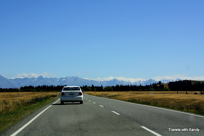
Since there was so much to see in New Zealand outside of LOTR, Charles and I decided we would only take one guided LOTR tour.  We ultimately went with a tour of Edoras, the capital of Rohan (the horse people), because it was one of the most spectacular natural locations in the movie and you can only visit it on a tour since it’s on private property.  We wanted to fully immerse ourselves in Middle Earth, and I can say with absolute confidence that we achieved this goal.  Edoras was filmed on Mt. Sunday, near Mt. Potts sheep station, which is located about 2 hours southwest of Christchurch. Ironically, the land of Rohan was filmed in the area known as Erehwon, New Zealand. Erehwon was the name of a fictitious country in a book by Samuel Butler, and is also Nowhere spelled backwards. How fitting.

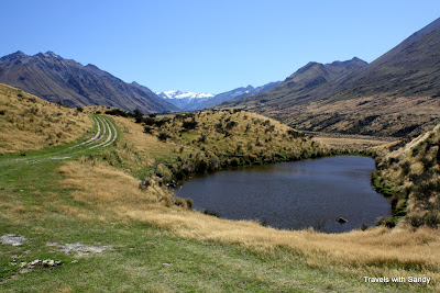
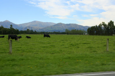
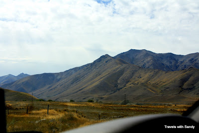
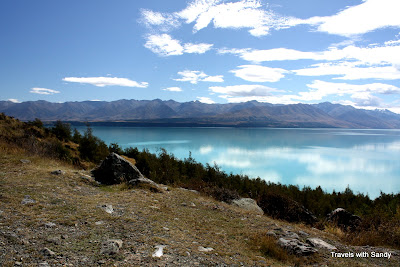
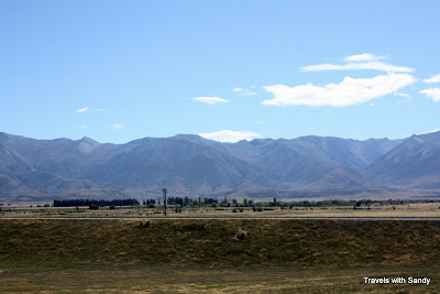
When we arrived at the edge of Mt. Potts, it was clear that we had entered Middle Earth. Peering over the edge of a hill, we saw Edoras on a rocky plateau in the middle of flat plains surrounded by mountains with a silver stream running through. It is just as Tolkien described Edoras in Lord of the Rings.


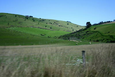
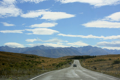
The kingdom of Rohan spread out before us in Erehwon, NZ.

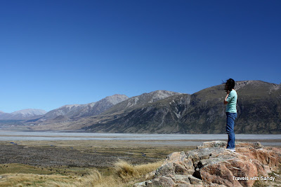
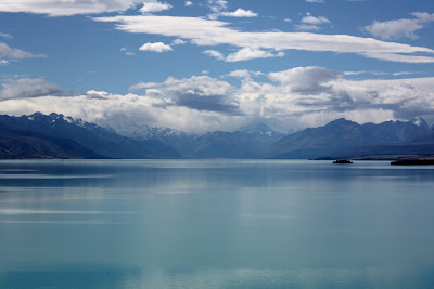
You can see Mt. Sunday/Edoras in this photo if you look closely. It is the big rock about halfway up and to the right in this photo.

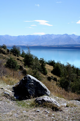
As our four wheel drive vehicle drove towards the rocky plateau on which Edoras once stood in the filming, I was filled with anticipation.  The kingdom of Rohan was the most stunning part of the movie, in my opinion, so my expectations were high.  I need not have worried.  Seeing it in real life was even better.


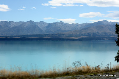
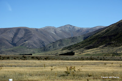
Mt. Sunday, home of Edoras.


Photo of Edoras from the filming of the movie (from Hassle Free Tours).

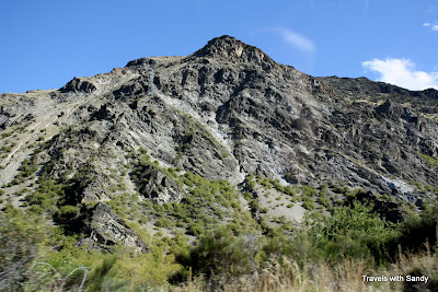
My photos have not captured a fraction of the scale of this setting. Imagine seeing this while being surrounded by miles of flat, grassy lands that are surrounded by mountains. It was one of the most beautiful places I have ever set my eyes on.

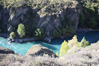
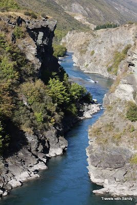
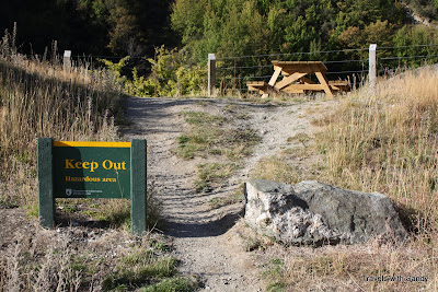
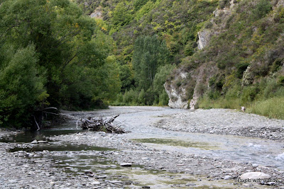
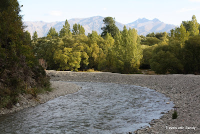
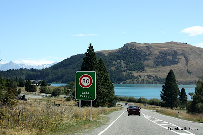
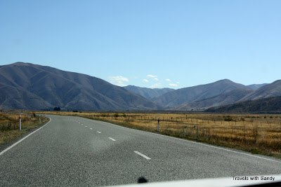
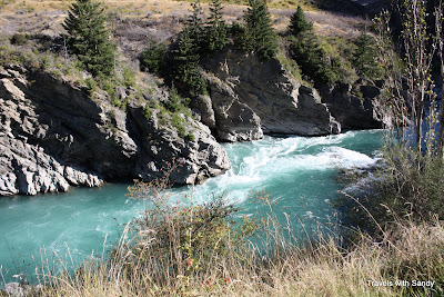
To get to Mt. Sunday, our SUV had to traverse a beautiful river and then drive up a steep gravel road, which only went halfway up. From then on, we walked right into Edoras.


The most beautiful place I’ve ever been. Mt. Sunday.

Once we got to the top, we had a 360 degree view of Rohan. It was simply breathtaking.  From Edoras, we could see the Misty Mountains and Helm’s Deep.  It was also very very very windy.  Click on any of these photos for a closer view.


Panoramic view from the top of Mt. Sunday.


View of the Misty Mountains from Edoras.


View of Helm’s Deep (top left quadrant of photo).

At this point, the tour participants were allowed to indulge their LOTR fantasies.  Our tourguide showed us pictures from the movie so that we could better picture the set.  The movie set took months to construct, but they only filmed for about a week.  After filming ended, per their contract, the film company had to restore everything, including the exact location of every tussolk (bush), back to its original condition and location.


Me on Edoras/Mt. Sunday pretending to be Eowyn.


Eowyn in front of Meduseld, Edoras.

Note: Image copyrighted by New Line Cinema.  The use of the above image is for informational purposes only and qualifies as fair use.  The inclusion of this photo in this post adds significantly to the post because it shows Edoras in its full glory.  Source: Google Images.


Our wonderful tourguide kindly indulged us and put up the flag of Rohan.

Following our hike up to Edoras, we reluctantly left and had lunch (provided by the tour company).  On the car ride back, the tourguide played the behind the scenes shows from the LOTR DVD box set, which was a perfect way to end our tour of Middle Earth.

Even if you are not a LOTR fan, Erehwon is a place worth visiting.  The scenery was epic and truly stunning.  It was… dare I say it…LEGENDARY.   It is one of those places where when you go, you figure a place this beautiful is sure to be easy to photograph.  But after taking some shots, you get depressed because the photos just cannot capture a fraction of what it really looks like.  I will remember this day and this beauty the rest of my life.

TIPS:  If you are at all interested in seeing any of the LOTR movie locations in New Zealand, I recommend purchasing “The Lord of the Rings Location Guidebook” by Ian Brodie.  It lists all of the movie locations by region and includes GPS coordinates and photos.  While I found it difficult to pinpoint the exact location of the locations much of the time, it is the only source out there for this subject matter.  There are two versions of this book – the small compact version and the huge coffee table version.  I bought the small version so it would be easy to carry with me.  Although this book is difficult to obtain outside of NZ, rest assured that it is available in every bookstore in NZ.

DETAILS on the TOUR:

We toured Edoras with Hassle Free Tours.  We were picked up in Christchurch at around 9 AM from our B&B and dropped off around 6 PM.  We had a fantastic experience with this company from booking to the tour itself.  They provide a well informed tourguide/driver, lunch, interesting commentary, and of course access to Mt. Sunday, which is on private property.  On the way to Mt. Sunday, the tour provides a rest stop, including rest rooms.  There are also rest rooms where you eat lunch.  Overall, we were completely satisfied with this tour.  Great service and stunning scenery!

For more information, see Hassle Free Tours’ website:

http://www.hasslefree.co.nz/pages/18/lord-of-the-rings-tour.htm


New Zealand: Kaikoura and Dolphins

2 07 2009

If you have read my posts on Hawaii, you know about my love of dolphins.  One of the many reasons I wanted to go to New Zealand was to swim with dolphins in their native habitat.  In Hawaii, we were able to witness dolphins swimming beside our boat, but to be actually in the water with them has been a lifelong dream.  Kaikoura, a small seaside community in the east coast of the South Island, is the perfect place to experience sea life and dolphins in particular because of its unique location.  The town of Kaikoura sits on the edge of a peninsula that juts into the ocean in an area where ocean upswells bring up an abundance of marine life from the Hikurangi Trench.  Rich marine life and nutrients are pushed up near the surface, which then attracts whales, dolphins, seals, albatross and other sea life.


On the Kaikoura Penninsula, looking towards the town.


Beautiful seaweed on the beach in Kaikoura.

We arrived in Kaikoura in the late afternoon, just in time to race to dinner before it closed.  Since we were in Kaikoura, which literally means “meal of crayfish,” we of course wanted some crayfish (what Kiwis call lobster) for dinner.  Despite the abundance of crayfish in Kaikoura, however, this luxury food item is still quite expensive when eaten in a restaurant because of its popularity.  Luckily, we learned through speaking with several Kiwis that there is a way to get cheaper and fresher crayfish in Kaikoura.

Here are the exact instructions paraphrased from our motel owner on how to find crayfish in Kaikoura:  “You need to drive down the Esplanade, past the town, and almost to the end of the penninsula.  You will see a crayfish stand on the left.”  Miraculously, we were able to find this stand because it appears there is only one such stand, at least the day we were there.  The stand closes at 6 pm, though, so make sure you get there in time!

I have included a picture of the crayfish stand below so you know what it looks like.  We were able to pick our own live lobster from the cooler and have it cooked up in front of us.  The stand has a couple of tables with umbrellas where you can eat your food.  The crayfish stand is actually very gourmet and offers quite a menu.  We were skeptical when we first heard about this stand because it is on the side of the road in the middle of a virtually uninhabited place.  But we are so glad we went and were able to taste the bounty of Kaikoura.  We highly recommend it!


The Crayfish Stand in Kaikoura.  Astonishingly, just across the road from this stand was a bunch of sheep on a hill.  You just cannot escape the sheep in New Zealand.

After our crayfish dinner, we wandered along the beach on the Kaikoura peninsula and admired its beauty.  The sealife is so abundant here that I didn’t realize until I was standing on the beach for 15 minutes that a seal was only a few feet away from me the whole time.  We watched a breathtaking sunset until it got too cold to stay.


Another beautiful sunset in New Zealand.

We had an early night back at our motel because we had to wake up really early for the dolphin tour the next day.  Also, Kaikoura is probably the smallest town we visited in New Zealand and there isn’t much to do besides enjoy the scenery and sealife.  At this point in the night, we were constantly monitoring the weather because there was rain and wind in the forecast and we were afraid the dolphin swim would be canceled.  Incidentally, we also ended up watching the British version of “COPS,” which turned out to be highly entertaining.  Who knew in this day and age that there were still designated town drunks in small cities across England?

When we woke up the next day, the weather was ominous and we could hear raindrops on the roof.  When I called the Dolphin Encounter to check, however, I was informed that our scheduled trip was still on!  In fact, the earlier dawn trip had already gone out.  We quickly got ready and had breakfast in the Dolphin Encounter Cafe.  When our group was called, we were fitted for wetsuits, jackets, and snorkles.  I was afraid I might get seasick so I took a remedy.  We were also instructed on how to and how not to interact with the dolphins.  You are not allowed to touch the dolphins.  The company emphasized that it was a privilege to share the water with the dolphins and our goal was to entertain them and not the other way around.

We reserved our dophin tour through Dolphin Encounter, a well respected company in Kaikoura.  Now I will take another moment to talk about dolphins and eco-tourism.  The popularity of dolphins has created an entire industry out of dolphin tours.  While most operations are very conscious of the delicate nature of these graceful but wild animals and their homes, unfortunately a few exploitative companies have given a bad name to swimming with dolphins.  That’s why it’s very important to find out as much you can about the companies offering dolphin swims before supporting them through your participation.  We chose to use Dolphin Encounter because the company puts a strong emphasis on environmental sustainability, limiting contact so as not to jeapordize the resident dusky dolphin population, and spreading awareness of the plight of dolphins and their habitats.  You can read their mission statement here: Dolphin Encounter Mission Statement.

Now that I have said my piece, we can go on to the best part of our Kaikoura visit – the dolphins!  As with all tours of this kind, there is no guarantee that you will see dolphins.  Unlike tours in other countries, though, in NZ if you don’t see what you are meant to see, you get some of your money back!  Luckily we were able to sight a large dolphin pod after only a short time.


We saw this boat from our boat.

The next part of this trip was FUN.  The boat basically followed the pod of dolphins around the ocean and dropped off the swimmers into the water from time to time.  When I was in the water, I could literally see dolphins in front of me, behind me, under me, and all around me.  It was one of the most exciting experiences of my life.


We also saw a seal. They are everywhere! I think this one was following me around.

Charles was smart and decided not to swim with the dolphins. Instead, he took some fantastic photos. I especially liked this series of shots.

What these pictures do not show, however, is how cold and rainy the day turned out to be.  Remember, we had to wear wetsuits in the height of summer just to swim in the water.  The weather was also rainy and windy that day, which made for cold, rough seas.  After getting in and out of the water 3 or 4 times, I started feeling seasick and very cold.  I chose not to go in the water again and the Dolphin Encounter people gave me blankets and hot chocolate to warm me up.  Unfortunately, my seasickness got the better of me and I got really sick.  When we got back to the base, I was able to take a hot shower and felt much better afterwards.

Despite my seasickness, which I think only happened because the seas were especially rough that day, I am happy that I was able to witness these magnificent mammals in their home.  I have always thought that dolphins were beautiful, but seeing them up close has made me appreciate their power and sleakness even more.  Next time, however, I hope to encounter them in warmer waters!


New Zealand: South Island Coastal Drive

15 05 2009

After a pleasant stay in Nelson, we set off on a scenic drive to Kaikoura, our next destination.  Remember when I talked about how the gorgeous scenery actually got better and better as we traveled south?  Well, this is one of the reasons we came to this belief.  While planning this trip, I was not thrilled that we had to drive approximately 4 hours from Nelson to Kaikoura.  I should not have worried, though, because there are plenty of worthy stops to enjoy along the way.

Just outside of Nelson are some beautiful hilly forests. They reminded us of the Black Forest in Germany. There is one section of road on Highway 6 that is extremely twisty. This narrow road hugs the mountains and includes some extremely white knuckled corners. And the most remarkable thing to us as Americans? There are no guard rails except for the hairiest of turns. When we mentioned this to one of our innkeepers, they laughed and said why should we spend our taxes on something like that? People should just be careful. Then they launched into some examples of people being found in their cars two days after driving off these ravines. Hahaha. Of course we were told this right before our drive. Those crazy kiwis! Of course I know they see us as paranoid Americans!


A particularly winding part of Highway 6 has sheer drops just a few steps from the edge of the road.  Don’t worry, you are protected by these poles every 30 feet or so.  So what if we saw some that were knocked down?  

About halfway between Nelson and Blenheim is a rest stop called the Pelorus Bridge Cafe. Two of our innkeepers suggested this rest stop not because of the food, but because there is a short hike you can do from the cafe that is beautiful. We didn’t actually do the hike, though, because we had a late start but I thought I would mention it for your information. In addition, as we found out, rest stops in NZ are few and far between. If you are craving mussels, be sure to stop in Havelock, the green lipped mussel capital of the world. Since we were not particularly interested in mussels at 10 o’clock in the morning, we unfortunately had to skip it.

Our hosts at the Baywick Inn suggested that we break up our drive by stopping for lunch in Blenheim, which is located in the heart of NZ’s famous Marlborough Sounds wine region. It is also exactly halfway between Nelson and Kaikoura. This suggestion didn’t take much convincing for us. We stopped at the Highfield Estate vineyard for lunch, a good winery that happens to have a tower from which you can see a magnificent view of Blenheim’s vineyards.


Vineyards in Blenheim are surrounded by the coast to the east and mountains to the west.

We also stopped by Cloudy Bay vineyard for a wine tasting. I’m not a wine expert, but the Sauvignon Blanc was delicious!


World famous white wine grapes from the Marlborough wine region.

After our short interlude in wine country, we continued our journey to Kaikoura. Once you leave Blenheim, the drive becomes more and more coastal the more south you go. We were on a schedule because we had booked a dolphin swim early the next morning. 


View from coastal highway 1 on the way to Kaikoura.

About halfway between Blenheim and Kaikoura is a rest stop called THE STORE. Be sure to stop here! Since there is only one road between these two towns and only one rest stop, it’s not hard to find. The Store has a wonderful cafe, restroom facilities, and several nice dining areas you can choose from to enjoy your beverages.

But the real reason to stop at THE STORE is its stunning backyard. THE STORE has a huge deserted beach you can explore, as long as you buy something.


THE STORE has a nice backyard.

We thought we were finished stopping once we began our final approach to Kaikoura, but we just had to do one more stop right outside of Kaikoura.


Coastal waters just north of Kaikoura.

Kaikoura is known for its abundance of sea life, and we had not even arrived before we discovered this seal colony next to the highway! We were able to see a lot just from the observation deck. There is no direct access to the beach below.


Ohau Point Seal Colony 


That’s not just seaweed in the water!

There are not many things in this world that are cuter than a baby seal.


A family of seals at the Ohau Seal Colony just outside of Kaikoura.

Did you know that one of the most unique characteristics of a New Zealand fur seal is that it can stand on its flippers?

Next: Dolphins!


New Zealand: Nelson and South St

27 04 2009

While we only stayed one night in Nelson, we wish we could have stayed longer.  We had not heard much about this city before our arrival. In fact, we only stayed in Nelson so that we could save an hour on the next day’s drive.  What we found, however, was a small but vibrant city that had a lot to offer. Not only is Nelson known for its art and music scene, but it also has a walkable and interesting historic downtown with beautiful Victorian architecture.  Did I mention that it is also one of the sunniest places in NZ?

 
Trafalgar Street in Nelson, NZ

You can take a relaxing stroll down Trafalgar Street, where we saw many inviting food stands and cafes.  Strangely enough, we saw a falafel stand, a German sausage stand, and a Japanese food stand.  We also saw lots of interesting shops, galleries, and boutiques, many housed in restored Victorian buildings.  We stopped by both an exotic knitting store and a wool outlet shop, among other places.


Trafalgar Street looking towards Church Hill.


We saw this cute coffee kiosk downtown.


Believe it or not, but this quaint Victoian building near Church Hill houses a law office. 


As always in NZ, this side street was clean and tidy.

On the recommendation of our B&B hosts, we made sure to take a walk down historic South Street.  South Street is famous because it is New Zealand’s oldest fully preserved street.  The cottages on South Street were built for local trademen and date back to 1863.   South Street is located just to the right of Church Hill.  

The houses were mostly wooden framed cottages, tiny by modern standards, but adequate for the 19th century tradesmen.

I loved the framing around the roofs.  Many cottage had what looked like steeples on them.

It’s amazing how a few decorative slats can transform a boring wooden house into a beautiful cottage reminicent of a gingerbread house.

Next: A Scenic Drive Along the Coast, some wine, and Kaikoura


Review: A Charming Inn in Nelson, NZ

22 04 2009

Over the course of our visit to NZ, we stayed at a multitude of hotels, bed and breakfasts, and apartments in a variety of price ranges. All of our experiences were extremely positive. From the high end B&B on Waiheke Island, to the gigantic apartment in Queenstown, to the very hospitable B&B in Kaiteriteri, everyone we encountered was ultra friendly, helpful, and contributed greatly to our NZ experience. Our favorite place to stay, however, was the charming Baywick Inn bed and breakfast in Nelson.


The Baywick Inn in Nelson, NZ

The Baywick Inn is an elegant but comfortable bed and breakfast located in a beautifully restored Victorian house in Nelson. The B&B is owned by a Kiwi and Canadian couple, Tim and Janet, who have poured their hearts and souls into the restoration of this beautiful home. Everything we saw was well maintained, clean, and wonderfully decorated. We loved the B&B from our first glimpse.

Janet was a chef in Canada, and it shows! Her breakfast was superb, and only enhanced by the interesting and lively conversation we had at breakfast. I can personally attest that her homemade Muesli is awesome. Be sure to ask her about all her Princess Diana tins and other memorabilia!


The Breakfast Room

We stayed in the Parkdale Suite, which in my opinion, is the best room in the B&B. The bedroom is beautifully decorated in a Kiwi Victorian style. Everything was placed for both looks and comfort, including the inviting bed. After hiking all day, this little piece of civilization was a dream to come home to.

The Parkdale has a modern ensuite bathroom that includes both a shower and a claw footed tub. LOVE!

The Parkdale also includes a private enclosed porch with a wonderful view of the middle of New Zealand. I am being serious – the white pole you see at the top of the mountain is the geographic center (centre) of New Zealand. 

We wish we could have spent more time just sitting on this porch contemplating life with our cool drinks. We slept with the windows open and it was divine.

Should you wish to relax outside, the Baywick Inn also has a nice outdoor area for guest use.

Now for the practicalities – the Baywick Inn is located about a 10 minute walk from downtown Nelson. Being in Nelson, it is close to the area wineries, art, and shopping, and about one hour from Abel Tasman National Park. As mentioned earlier, you can hike to the center of New Zealand, which is supposed to be a nice scenic walk. The inn provides a computer for guest internet use for a small fee, but there is also free wireless internet throughout the house.

We only stayed a night at the Baywick Inn and we wish could have stayed longer. We felt truly relaxed at this B&B. In addition, Nelson has enough sites and activities that a visitor could easily spend 2-3 days here and never be bored.  Next time we are in the Nelson area, we will definitely be ringing up Janet and Tim for another stay here!


New Zealand: Abel Tasman National Park

20 04 2009

After arriving in Picton, we drove straight to Kaiteriteri Beach, our home base for the next two days.  The plan was to kayak the entire length of Abel Tasman National Park, which is located on the beautiful northern coast of the South Island.  Abel Tasman National Park is a pristine coastal wonderland, featuring hiking trails, camping grounds, and a multitude of beaches along the clear turquoise waters, and that’s just on the land.  By sea kayak, visitors can explore private coves, enjoy inaccessible beaches, and witness a multitude of sealife in their native habitat, including dolphins and seals.  A seal colony resides on Tonga Island, located just off the coast on the northern end of the park.  The park is also serviced by frequent water taxi service that pick up and drop off at various points in the park.  


Abel Tasman National Park, as seen from the sea.

We decided to stay in Kaiteriteri because it’s as close as you can get to the park.  There is a tiny hamlet called Marahau that is even closer to the park, but boats and kayaks launch from both places.  Another alternative for a place to stay near the park is Motueka, a small town 15 minutes south of Kaiteriteri.  Many of the sea kayaking operations offer van service from Nelson as well, but you have to wake up earlier to catch them.  We elected to stay at a friendly B&B called Robyn’s Nest located on the hill above Kaiteriteri.  

Kaiteriteri Beach is a crescent shaped white sand beach located just ouside of Abel Tasman National Park.  We arrived in Kaiteriteri right in time to see this magenta sunset.  


Kaiteriteri Beach

Unfortunately, that first glimpse of Kaiteriteri Beach was the only time we would have clear skies for the next day and a half.  On the first day of our planned sea kayaking excursion, our trip was cancelled due topouring rain with strong winds.  We lost an entire day because the weather was too rough for any outdoor activities.  Although it stopped raining for most of the second day, our sea kayaking trip was cancelled again due to continued high winds.  We were able to salvage our visit, however, by going hiking (or as the Kiwis call it, tramping) instead.  

We were still able to see part of the park from the water, however, because we made use of the water taxis to deposit us in the park.  The water taxi is an easy way to arrange hiking expeditions in the park because they drop you off and pick you up.  The companies do this all day long and can arrange hikes from short to long.  We chose to hike the trail between Bark Bay and Torrent Bay, said to be the one of the most scenic parts of the trail.

On the way to Bark Bay, our water taxi stopped by the famous Split Apple Rock so we could snap some photos.


Split Apple Rock, Abel Tasman National Park, New Zealand

We started our hike at Bark Bay, which is the site of one of the campsites along the trail.

Bark Bay is a white sand beach with crystal clear blue water.

The trail between Bark Bay and Torrent Bay takes about 2.5 hours to hike. It takes you along the coast, where you will catch glimpses of the glittering sea, and inland, where you will feel like you are walking in a primeval forest.  The trail is well maintained and while it has steep sections, it is not a difficult hike.  We were mostly distracted by all the natural beauty on the way.

Because of the rain, the park was especially green on the day of our hike.

Along the first half of the trail is a fork that leads to an ocean view. The sign will say that it is a 10 minute detour. Take the detour because the view is FANTASTIC! Be advised that the trail is 10 minutes each way though.

We had a picnic lunch here.

It was hard to gauge how long the trail would take us to complete because there are not a lot of signs. However, I believe that if you walk at a normal pace, you will be able to make your pick up time easily.

According to the map that was given to us by the water taxi company, this bridge over the Falls River is about the midpoint of the trail. There is a sign there that says Torrent Bay is still an hour and 45 minutes away. This is an overestimation. It did not take nearly as long to get back to Torrent Bay. We rushed a bit from here and got to Torrent Bay in about an hour. You could easily walk from the Falls River to Torrent Bay in an hour and 15 minutes.

You have to walk across this swing bridge to meet your boat!


The Falls River

Finally, we reached Torrent Bay.

Another gorgeous beach awaits at Torrent Bay.

We were picked up at Torrent Bay by water taxi and driven back to Kaiteriteri. I believe the water taxi will wait for you if you are a little late getting back to the meeting point because the driver asked for us by name. We also learned a funny Kiwi saying from the driver when he was giving someone directions. He said, “First you make a left at X, go two blocks, take a right, then Bob’s your Uncle!” Apparently, it means the same thing as “good as gold,” another common Kiwi saying.

The ride back to Kaiteriteri was also very scenic.

When we got back, we finally got to see clear skies on Kaiteriteri Beach.


While we were disappointed that we didn’t get to do the two days of sea kayaking as planned, we were happy that we were still able to see the beauty of Abel Tasman National Park on foot.  In fact, now that I have hiked Abel Tasman, I would recommend seeing it this way as well!  This is especially convenient for those who are short on time.  Hopefully next time we will be able to explore the park on a sea kayak.


New Zealand: Passage to the South Island

17 04 2009

The best way to travel between the North Island and the South Island of New Zealand is by ferry. This three hour sea passage is both convenient and incredibly scenic. Passengers and cars sail out of Wellington Harbor out to sea and enter the South Island through the Marlborough Sounds and majestic Queen Charlotte Sound.  Just thinking of this sea passage makes me sigh.
 

View Larger Map

We booked the Interislander ferry through our hotel a day in advance. Visitors can also take the Bluebridge Ferries, which take a little longer. Both ferry companies sail with large multilevel ships that are full of amenities such as lounges, cafes, bars and observation decks. Some even have children’s play areas and movie theaters. There are 5-6 crossings a day, depending on the season.

We left Wellington on the 10:25 AM ferry.  Click on any of the pictures below for a larger view.


View of Wellington from the Ferry


Passing another ferry going in the opposite direction.

We passed by these lighthouses and land formations as we left Wellington Harbor.

After leaving the harbor, the ship is out at sea for a while. I passed the time reading the NZ gossip mags since there was nothing to photograph for more than an hour. NZ gossip magazines are almost as good as the British Tabloids. I read all about Prince William’s relationship with Kate Middleton.

It was obvious when we reached the Marlborough Sounds because we began to see green and yellow islands and peninsulas rising out of the sea. A dense fog rolled over the Sounds, which only added to the grandeur and mystery of the Marlborough Sounds. It also had the effect of making the colors of the land more intense.


Against the backdrop of the high cliffs, the sailboats looked like white birds fluttering across the water.


After cruising through the waters of the Marlborough Sounds, the ship made a big turn into Queen Charlotte Sound. Since we would not be able to do the Queen Charlotte tramp, one of New Zealand’s Great Walks, we were happy that we were able to catch a glimpse of this beautiful area from the water.


Finally, we reached our destination, the port city of Picton.

Although Picton is a small town that serves mainly as the south terminal of the ferry, it does this job well. We were able to pick up our rental car without any problems right at the ferry terminal. There are several rental cars companies to choose from, but if you want a choice in what you rent it’s better if you book ahead of time. We drove into town to have lunch before embarking on the beginning of our South Island adventure.

Next: Abel Tasman National Park